GCAP: Indoor Version

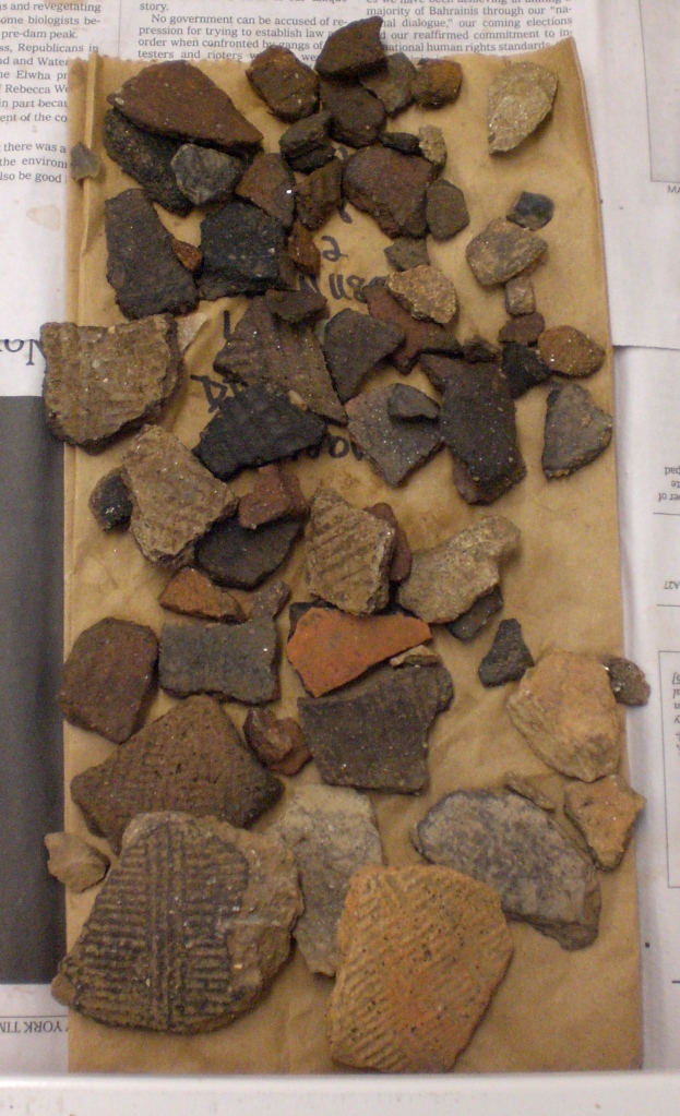
Some freshly washed artifacts laid out to dry. These came from one of the plowzone levels; not surprisingly, they include some notable examples of Pisgah ceramics (the lower few sherds in particular).

Finally, we’re ready for round two of research for the Garden Creek Archaeological Project! After a few weeks of post-fieldwork organization, I’m back in the North American Range of the University of Michigan’s Museum of Anthropology to process and analyze the artifacts we collected this summer at the Garden Creek site. Luckily, some familiar faces will be helping out with this phase of investigation.

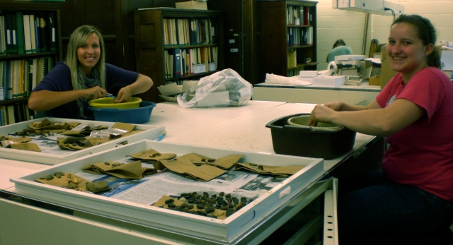
The gang is back together again! Erika and Claire are taking time out of their busy class schedule to wash artifacts.

In the next few weeks, field-tested students Claire, Sophia, and Erika and I should finish washing the last of the artifacts and will begin looking at some assemblages in more detail. Claire and Sophia will be focused on the ceramics, while Erika will be working on the lithics. Before too long, we hope to be able to post some ongoing interpretations based on our laboratory findings.

Posted in Lab Work, Students | 4 Comments

Final field photos

After a whirlwind week of photography, profile mapping, micromorph sampling, and backfilling, we successfully completed the first and longest phase of fieldwork for the Garden Creek Archaeological Project. Alicia and I made the trek back to Michigan over the weekend, and soon, I will begin analyzing the artifacts from the site at the University of Michigan Museum of Anthropology with several of the students who joined us earlier this season. Throughout this process, we plan to regularly update this blog with our ongoing findings, so please check back often!

For now, we offer a few photos of our last week in the field, including the final shots of the 110 cm deep earthwork ditch that kept us busy in August. We would also be completely remiss if we didn’t take this opportunity to thank our local archaeological colleagues for their help and advice this season (in particular, Scott Ashcraft of Pisgah National Forest, who spent a week in the ditch with us) and the many residents of Plott Farm who facilitated our work this summer, especially Will and Brittany Warren, Joe, Brenda, and Jordan Worley, Tom and Susan Anspach, and Robert and Julie Cathey. The ability to work so closely with the local community made this one of my most fulfilling field experiences, and I can’t wait to continue our collaboration in the near future. Project members plan to be back in Haywood County intermittently through the next year, to give talks at the local schools, install at exhibit at the Canton Area Historical Museum, and undertake some quick and focused excavations next spring — we’ll see you all again then!

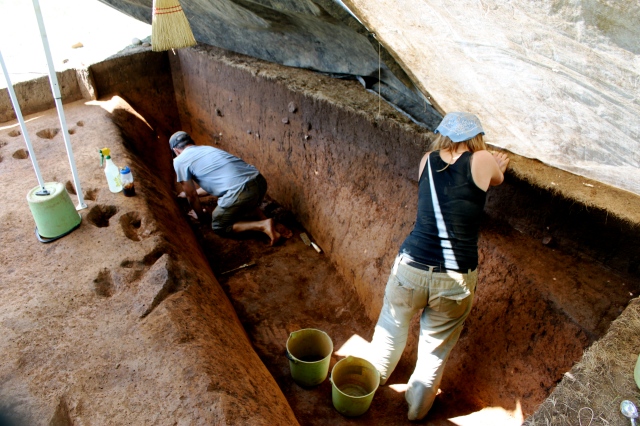
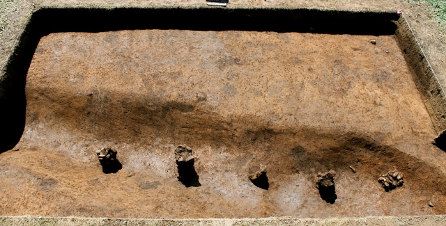
Scott and Alice clean scraping the ditch for a photo. The holes on the left are bisected stains and postholes.

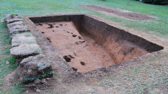
Unit 8, with the ditch entirely excavated, looking grid southwest (about true west). The filled-in unit in the upper right was the crosssection tench. According the the magnetometer, the ditch turns a corner in the grassy area between the two units.The ditch, looking grid south. It just barely starts to turn a corner in the southwest portion of the unit. The ditch itself comes out of the west wall at an angle.

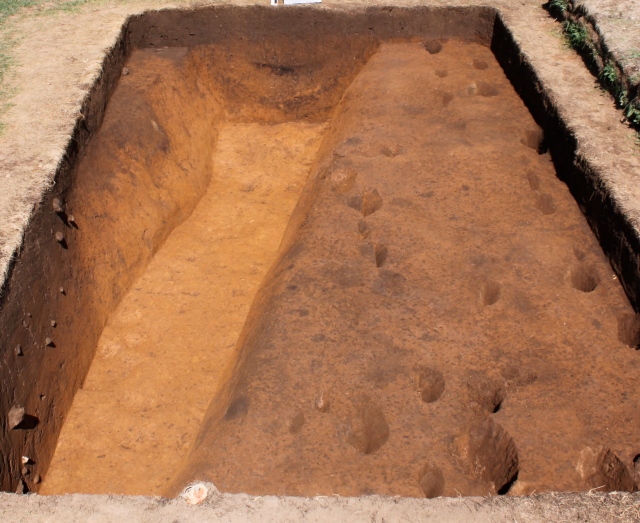
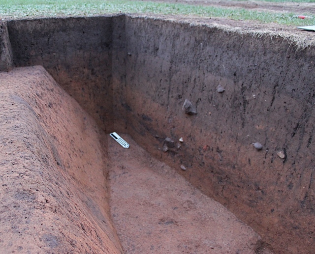
The ditch looking grid north. In the bright, late afternoon sun, you can really see how yellow the subsoil clay is! The dark area of the west wall (lower left) is actully ditch fill, because the ditch itself exited this wall at an angle. The dark stain in the upper left portion of this wall is an intrusive pit the probably dates to the lter Pisgah phase use of the site. In the north profile, you can see the three major zones of ditch fill, some of which include lenses of dump and erosion episodes.

Southwest corner of Unit 8. The three major (some homogeneous, some striated) zones of fill are visible in both the south and west walls here.

Inside the ditch, looking north. The dark spot in the north wall is the remains of an isolated dumping event that included quite a bit of charcoal. Note how steep the walls are and how flat the floor is!

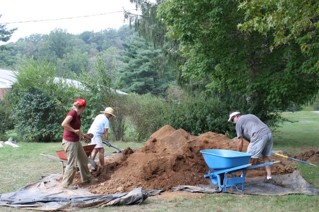
Backfilling with John Wright and Rita Pelczar (my parents!) who drove down from Madison County to help us close down the site for the season.

Posted in Uncategorized | 2 Comments

Bisecting postholes, from Alicia Michalski

[While we finish up in the field today, Alicia Michalski has provided a great post on what has been keeping her busy for the last few weeks: bisecting postholes!]

Alicia, bisecting a posthole.

While the ditch has been the main focus in the latter part of our excavations, I have been concentrating on the post holes that lay outside of the larger feature in Unit 8 (the 5×3).Th ese may look less impressive than a massive earthwork ditch, but the data we collect when we bisect postholes can reveal the answers to very important questions. Bisecting a post hole and recording the various measurements is one way to find a possible pattern among what at first looks to be a random scattering of features.

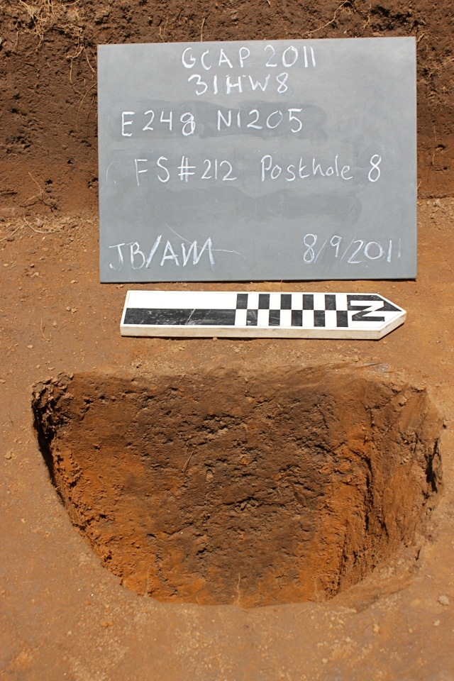
In order to bisect a post hole, I first need to clean scrape the surface area in which I am working. This reveals darker sediment, more brown in color than the yellow fill which surrounds it, indicating a possible post hole. Then I take a top elevation of the post hole, which indicates the depth at which the post hole was dug in relation to the surface. Next, I cut the post hole in half and create a mini-profile, digging down and keeping the back wall as clean and straight as possible. The difference in the color of the sediment is one of the most important factors in this process. It reveals the boundary of the post hole, if it veers off or is diffuse (indication of a rodent burrow) and where the post hole stops. This is why keeping the back wall clean and smudge-free is critical.

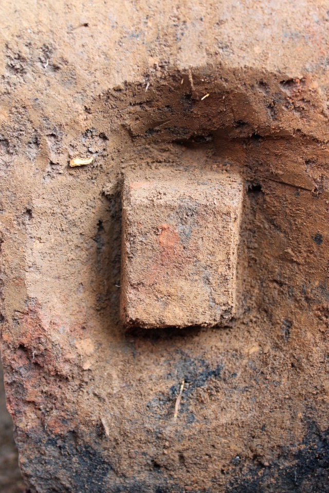
One of the several dozen postholes we've bisected in the last few weeks. The posthole is the dark stain in the middle, surrounded by yellow subsoil.

Once I’m sure I’m at the bottom of the post hole, I record bottom elevation and a description of how the bottom is shaped (pointed, rounded, or flat). Then I take out the remainder of the post hole from the wall I had bisected, leaving a round column from where the sediment that had filled the post hole had been. The sediment from the post hole is then screened to reveal any artifacts that may be associated with it.

Bisecting a post hole is certainly a process that takes a bit of skill and a lot of patience when the lighting isn’t cooperating. But the data that has been collected from all the posts will be invaluable when it comes to teasing out similarities and differences in post features that might relate to different architectural structures.


Posted in Excavation, Students | Leave a comment

Front page news

Today’s Haywood County Mountaineer newspaper published two great stories on the Garden Creek Archaeological Project. If you want to check them out:

Dig at Garden Creek shows renewed interest

Property owners preserve history

Thanks to Peggy Manning and the Mountaineer for the coverage!

Posted in Uncategorized | Leave a comment

Earthwork update

As of today, we have one more week at Garden Creek this season. To my considerable surprise, we seem to be on track to finish without much stress orscrambling (famous last words). We now have backfilled all but one of the eight units we opened this summer, so we are able to give our full attention to the earthwork ditch.

Cross-section profile of the earthwork ditch in Unit 6, before Stephen Carmody (PhD student, University of Tennessee) removed the flot column last weekend. The top zone of fill is dark, charcoal rich, and includes a considerable amount of mica sheet fragments. The middle zone of fill is yellow and more clayey. The bottom zone is subtly striated with brown and yellow sediments. We think these represent a series of dumping and erosion episodes that followed the initial excavation of the ditch. For scale, the floor of this unit is about 1.5 meters across.

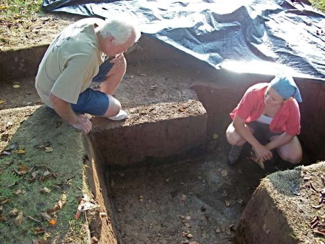
When we last posted about the ditch, we had removed the first of three zones of sediment that filled the ditch, which revealed a line of rock filled postholes that more-or-less followed the shape of the ditch. The help of Pisgah National Forest Archaeologist Scott Ashcraft and some local volunteers have allowed us to move a lot more dirt since then!

Jess and Alicia successfully removed the middle zone of fill just before public archaeology day. Some of the rock filled posts continued into this zone, but we’ve discovered that they all end before we hit sterile at the base of the ditch itself.
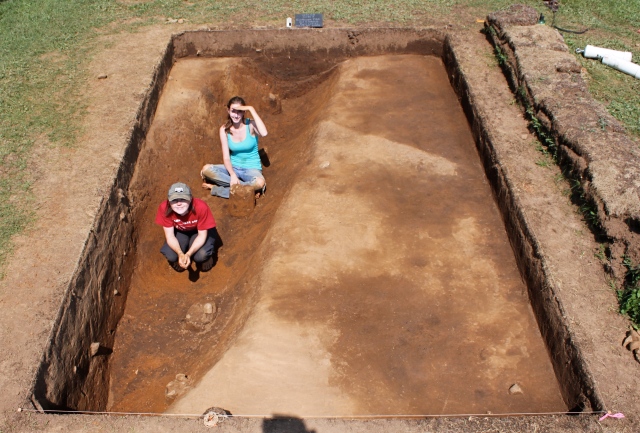
Jess and Alicia at the base of the ditch, on top of the third/bottom zone of fill. The mottling in the high area on the right is caused by differential drying.

This past week, we moved into the third zone of fill. This zone has much fewer artifacts than the zones above it. Luckily, it is pretty easy to differentiate it from the homogeneous, yellow clay underneath.
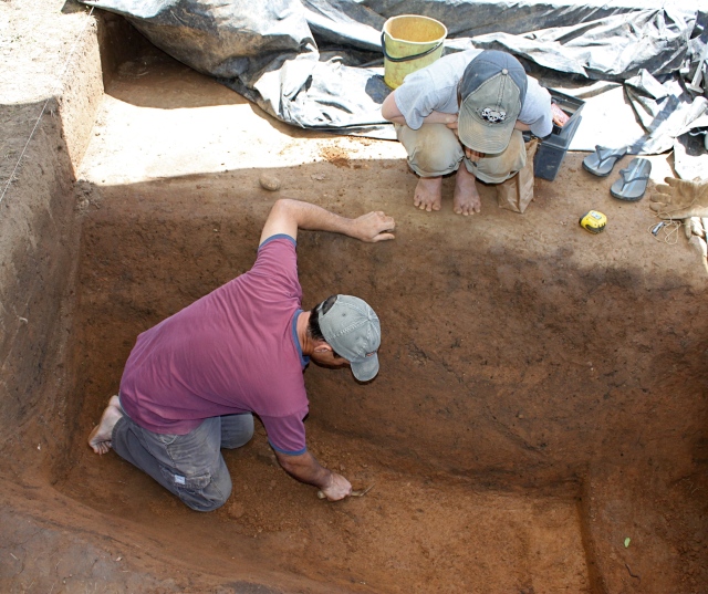
Scott cleaning the ditch wall and floor, under Jess's supervision.

As mentioned above, this zone includes bands of gray and yellow sediment, which we think represent different dumping and erosion episodes. Some of these dumps are pretty discrete, and include fire cracked rock, cobbles, and broken portions of pots. Jess excavated one of these episodic features near the base of the ditch.
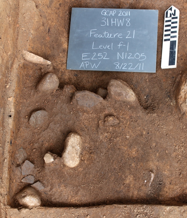
Cluster of rocks and potsherds (lower left) possibly representing a dumping episode in the third zone of ditch fill.

Next week, we’ll finish cleaning out the little bit of fill that’s left in the ditch. Then we’ll bisect the postholes we’ve identified outside the ditch, take some micromorphology samples, and backfill, backfill, backfill! Then back to Michigan for artifact analysis….
Posted in Uncategorized | Leave a comment

Public Archaeology Day

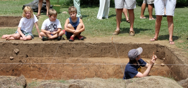
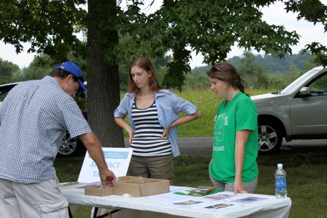
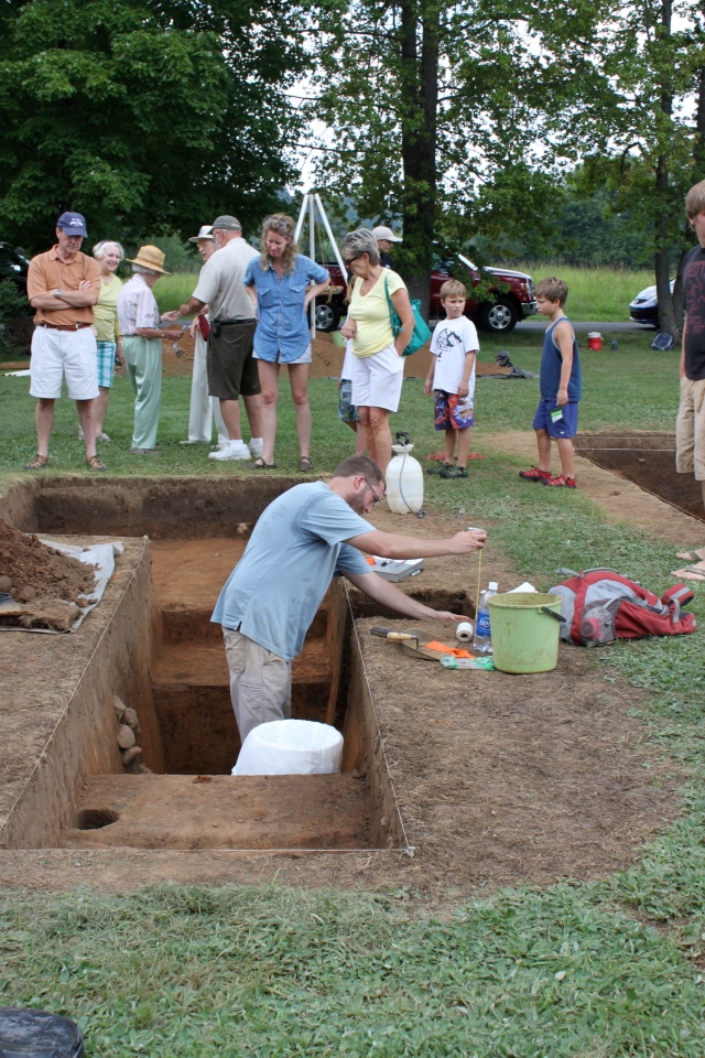
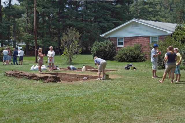
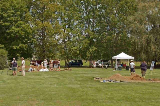
Last Saturday, we hosted Public Archaeology Day at the Garden Creek Site. Thanks so much to everyone who came out to support the project. We really enjoyed sharing the work with you all!

Posted in Uncategorized | Leave a comment

What’s going on besides the earthwork

It’s true, most of our attention for the last few weeks has been devoted to the earthwork ditch, where there’s quite a lot of material to excavate! However, we have not left the rest of the site behind, particularly as we approach the end of the season.

Chatting with a site visitor in Unit 3.

Last week, I spent two days back in Unit 3, with its large stratified pits. I collected two different types of samples that will be processed for further analysis. First, I took a series of sediment samples for flotation from a 50×50 square cm column that cut through all identified levels of both pits. Matrix from this”flot column,” which was collected in natural levels, will be run through a tank of moving water. This will not only separate soil from artifacts, but also heavy artifacts (like sherds and flakes) from lighter remains (like seeds and charcoal).

The Unit 3 flot column, with the plow zone partially removed.

After removing the flot column, I proceeded to take micromorphology samples from several profiles of the unit. Following the advice of geoarchaeologist friend Dr. Sarah Sherwood, I carefully removed cubes of dirt from different layers and at the boundaries of different layers. Soon, we will look at these samples under a microscope to see, among other things, if there are any microartifacts or evidence of weathering between layers that we couldn’t see with the naked eye.

One of the micromorph samples. This one catches the fill of the bottom (first, larger) pit, the burned clay wall of the top (second, smaller) pit, and the fill of the top pit.

With all of that complete, today we finally finished backfilling and re-seeding Unit 3. For now, our attentions are divided between the ditch (in plan and profile views) and on our Public Archaeology Day. If you find yourself in western North Carolina tomorrow (Saturday, August 20), please join us at the site from 1-3pm to learn more about the project in person. Just get in touch ([email protected]) if you need directions!

Posted in Uncategorized | 1 Comment

A student’s take on GCAP

(Today’s blog post comes direct from Sophia Reini, a University of Michigan undergraduate enjoying her first foray into the field…)

Thus far my experience on the Garden Creek Archaeological Project has been intellectually stimulating and tremendously enjoyable. Up until this point I have never been part of a dig. I have learned everything from troweling, screening, and mapping, to taking C14, flotation, and micromorphology samples.

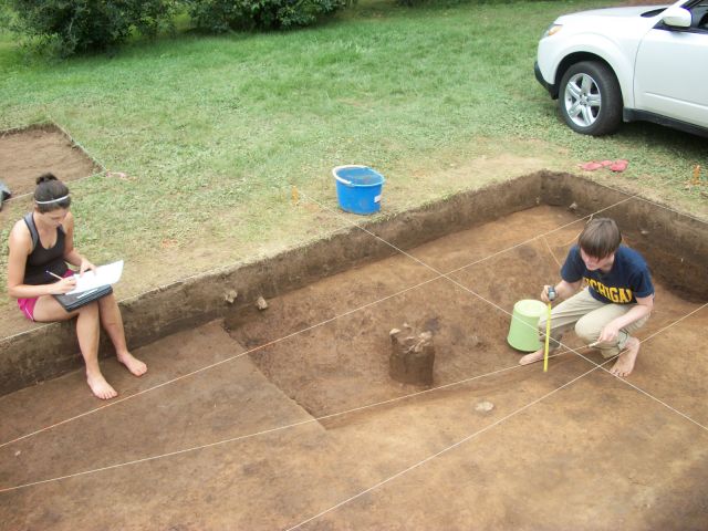
Sophia (left) and Jess (right) mapping some of the posts following the removal of the first zone of fill in the earthwork ditch.

One thing I have been working on a lot since I have been here is the 5×3 meter unit that has been placed over a massive ditch. I first started by helping Alice and Jess clear off the entire plow zone layer from this unit. Next we clean scraped the whole thing Jess and I began to map out the post hole, pits and the ditch. We were able to identify these features by simply looking at the differences in the colors and textures of the soil.

5 meters of the earthwork ditch excavated to the base of the first of three zones of fill. The top of the next zone is very similar to the clay subsoil, but with a lot more charcoal and burned clay, among other artifacts. We think the vertical columns of rock (which continue into the next zone) are rock-filled postholes.

What I have been working on rigorously the last few days has been the ditch itself. With Jess and Alicia, I have been scraping out the dark top layer of ditch fill to reveal the yellow soil beneath it. I have found this part of archeology very meticulous but exciting! We have been careful in leaving the clumps of rocks we have been finding in the center of the ditch because we believe them to be postholes that were filled up with rocks. Also I have been finding many long sheets of mica and some fairly good size pieces of ceramic.

Ditch-level view of the line of rock filled postholes (at least, that's our current interpretation).

On Friday, we started to dig out the second layer of fill in the ditch. This layer is more yellow in color and has massive amounts of charcoal and daub mixed in with it. Also, another rock cluster at the north end of the unit has been uncovered, and it looks similar to ones found in the first later of fill. We have gotten a lot done with this layer in the last two days alone and should finish soon.

Alicia, Jess, and Sophia starting to remove the second zone of ditch fill.

Overall I have enjoyed myself tremendously and will be sad to leave the wonderful weather and dig site behind. I cannot wait to get back to Ann Arbor and start working with Alice in analyzing of the data we have collected thus far so that we can have a better understanding for what this site was used for.

Posted in Excavation, Features, Mapping, Students | Leave a comment

The top zone of ditch fill

The earthwork ditch as of Saturday afternoon. The northern portion of the ditch has been excavated down to the base of the top zone of ditch fill. We will excavate the southern portion (top right of photo) to this same level before removing the next zone of ditch fill. In this middle, yellower zone, you can see a scatter of dark brown post holes that have yet to resolve into an intelligible pattern.

The excavations of the ditch enclosure at Garden Creek continued into this weekend, culminating in the photo above. Although we still have more of the top zone of fill to remove in the southwest corner of the excavation block, we have exposed the middle zone of fill across about two-thirds of the exposed area.

As shown above, in the presently un-excavated portions of the ditch, the top zone of fill is a dark, gray-brown sediment that stands out sharply from the surrounding yellow clay. Intermixed with this sediment, we found some brushed and check-stamped Connestee ceramics and a fair amount of mica, from fingernail sized fragments to 10 cm long sheets. We’re currently wondering if these fragments represent the refuse produced by the manufacture of special mica artifacts within or nearby the enclosure.

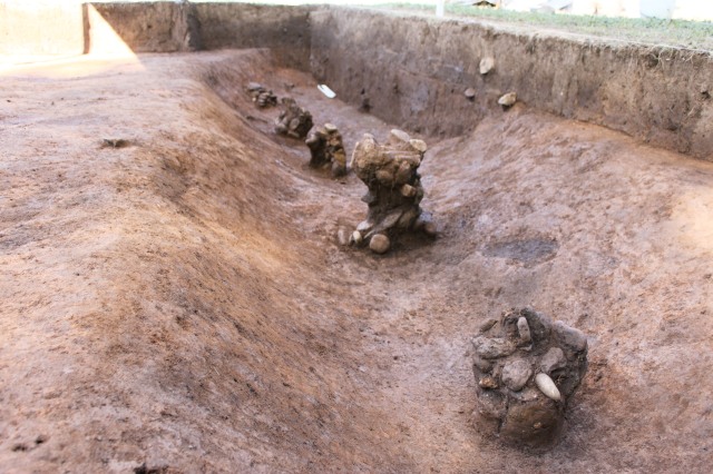
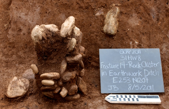
Rock column in the middle of the ditch.

In addition to these artifacts, the top zone of fill also included at least three vertical columns of small rocks, roughly evenly spaced through the center of the ditch (above). We have cleaned one of the columns pretty thoroughly to show the vertical stacking of the rocks, but we have left the others roughly pedestaled to be cleaned later, once we determine if there are additional clusters further south in the ditch. Our best guess now is that these were large postholes that were dug into the filled-in ditch, and later filled with rocks after the posts were removed. Of course, this idea is more than open to revision (particularly if other archaeologists have any ideas!). What we are sure of is that this ditch has a complex history of construction, infilling, and post-infilling architecture, which we hope to learn more about in the upcoming week.

Posted in Excavation, Features | 1 Comment

Mica preview

Undergraduate field crew member Sophia Reini will be posting a more detailed report of this week’s excavations soon, but for now, a preview:

Mica fragment in the earthwork ditch.

On Wednesday we began to excavate the top zone of fill in the earthwork ditch. In the process, we have found delicate sheets of mica at the boundary between this zone of fill and the one below it. It’s been difficult to expose these delicate artifacts without removing them completely, but over the next few days, we’ll take our time to see if they resolve to form some sort of lining. Considering the importance of mica in Hopewellian ritual assemblages, we are excited to find it concentrated in this earthwork ditch; it might be able to tell us something about Middle Woodland interactions at Garden Creek.

Posted in Excavation, Features | Leave a comment